


The famous Cliff Walk has fully re-opened after a two-year hiatus due to repairing storm damage. But don’t be deceived, the “Walk” is no stroll on the beach! About a third of the free, 3.5 mile coastal path is across very rocky terrain. Sometimes the large, relatively flat boulders provide fairly easy passage, but other portions require some climbing, as well as navigating loose, sharp rocks. It could be treacherous if conditions are windy and/or wet and slippery. The other two-thirds feature paved or gravel paths, most with guard rails. There are numerous points to stop for photo ops or just contemplate the beautiful scenery.
Today was a beautiful, slightly cloudy, breezy day in the 70’s; perfect for the walk. It took us about 2.5 hours with lots of photo stops and slow, careful movement across the rocks. It was a fabulous experience with unmatched views, not to mention a different perspective of the massive Guided Age mansions spread out like a string of pearls along the rocky coast.
TIPS: There are new public restrooms by the “40 Steps” portion of the Walk, near the Breakers on Narragansett Ave. Wear good rubber-soled shoes and
 go with a friend.


Sims Pond.
The Blue Ridge Parkway is a hikers paradise. With more than 70 trails along the North Carolina portion of the Parkway, you can find something for every level and interest, from easy to strenuous.
Close to Blowing Rock, near Parkway Craft Center at Moses Cone Manor is the Julian Price Memorial Park featuring a beautiful lake and lovely picnic grounds. BTW, you can rent canoes and row boats by the hour at the boat ramp on Price Lake. Just a few yards from Price Lake you will find Sims Pond (milepost 295.9) and a nice hike with a variety of scenic pleasures.
Officially the Green Knob Trail, this trek is also referred to as the Sims Pond Trail. The well-cut, 2.4 miles loop trail takes hikers 500′ up through dense forests with ancient soaring trees, across pretty little streams, over massive logs, under the Parkway (at .06 miles), across pastures complete with perfectly proportioned apple trees and resident cows, to fields of wildflowers and butterflies.
There are a few strategically placed benches along the way to relax (or rest) and take in the sights, sells and sounds of nature at its best. The most strenuous part is about a 20-minute section up to the pastures, where you are steadily climbing. Generally, a moderate hike, the trip takes anywhere from 50 to 90 minutes, depending on how fast you hike and if you take a break to enjoy the experience.
Simply put, the Green Knob Trail has something for everyone.
For info on trails along the Parkway, visit: www.blueridgeparkway.org/

Rubus idaeus – wild raspberries. Can the bears be far behind?

Whenever we emerged from the woods, beautiful Thistle were abundantly in bloom.

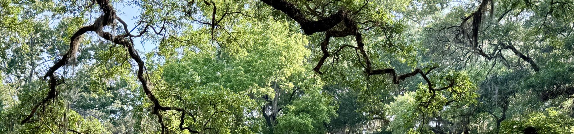
Canopy along the Green Knob trail.


The Visitors Center of the Roan Mountain State Park. An easy 0.4 mile trail from the Center will lead you to the Peg Leg Mine.
A Treasure Hunt with GPS Coordinates
The High Country of NC is located very close to the Tennessee state line. Today we spent some time geocaching in Tennessee’s Roan Mountain State Park. Although best known for its beautiful fields of rhododendrons, the Roan Mountain State Park has a lot more to offer.
For those uninitiated in the world of geocaching, it’s a wonderful outdoor activity for individuals and family members of all ages. It’s a treasure hunt using GPS coordinates. The hidden “caches” vary in size from micro (think old-fashioned film container) to macro (large ammo box). Each container will have at least a log book to record your visit and, depending on the size, room for trade-able items such as pins, coins, small toys, etc. It’s customary if you take an item from the box, to leave another behind. “Travel Bugs” are items with serial numbers that are meant to be moved from site-to-site. We love travel bugs, but they are rare.
Playing this world-wide game is fun, easy and free. Go on-line to http://www.geocaching.com, create a name for yourself, family or partner and look up the area you’d like to search. A zip code entry will help you get started. There are literally thousands of hidden caches and they are all over the world, in both urban and very remote areas. You simply enter the coordinates you find on-line in a handheld GPS unit, (including one from your car) or a smart phone (download the app for free). The one downside of using a smart phone when you are out on a trail, is that if you lose reception, you will literally be clueless. In an area with good service, a smart phone can direct you to hidden caches near your current location.
Enterprising players can also hide caches for others to find. Today, thanks to the Trailbreaker team, we had a nice assortment to look for. They have gotten permission from the park service to place their caches throughout the Roan Mountain State Park and have done an excellent job with their clues and with keeping their sites maintained. It was a rare treat for us to actually meet them just after we found one of their hidden treasures.
I promise when you geocache you will find out interesting information and see things you never saw before (even if you’ve driven by dozens of times).
Happy hunting!

The entrance to the abandoned Peg Leg iron mine.

Entrance to The Miller Farmstead property, home to multi-generations of a hardworking mountain farming family.

A typical hidden cache, in a camo-wrapped disguised box. We pulled this out to demonstrate, but generally, they are hidden behind rocks, under leaves, tucked in crevasses, hanging from a branch, concealed in a log, or sometimes placed in a magnetized container and stuck behind something metal. You will have to look!

When the weather is gorgeous in the North Carolina mountains, there is nothing like taking in the incredible views. Hiking trails are abundant and for every level of ability. These photos feature a stop right along the Blue Ridge Parkway, a short easy hike and a much more strenuous option – each with their own rewards. Just pay attention to the descriptions (easily found on-line) and be sure to be prepared with the right footwear, clothing, hat, walking stick (sure helps on the steep walk back downhill) and water. Oh yeah – don’t forget your camera!

The summit of Hawksbill Mountain, at 4,009′ rewards hikers with incredible panoramic views of the Linville Gorge.

A 1.5 round-trip hike from the trail head, takes climbers up 700′ in elevation! It’s strenuous, but what’s the rush . . . The Linville Gorge plummets 2,000 feet below. Located in the Pisgah National Forest, off Hwy 181. On a really clear day they say you can even see the skyline of Charlotte from the top of Hawksbill Mountain.

Sunset at Beacon Heights. Just a 15-20 minute hike will bring you to some of the most glorious vistas along the Blue Ridge Parkway. Parking for the trail head is located off MP 305.2 at the intersection of Grandfather Mountain and Hwy 221.

Price Lake, just off the Blue Ridge Parkway, as the sun drops behind Grandfather Mountain.

Fences & flowers along the Blue Ridge Parkway.


")
")
")

")


