

I have decided that Bryce Canyon deserves a dedicated post. It was our favorite of the trip. So incredibly spectacular that it’s hard to describe. Mark, our guide, said we had to get in the Park really early. Eating breakfast at 6:30 AM, we were questioning that decision, but it was spot-on.


As we left the hotel, we could still see some smoke in the air from a nearby wildfire the day before. It created a slight haze in one direction. Very few other visitors were around when we entered the Park. It was cool enough for a sweater as we walked along a pretty forested path. And then – wow, we faced one of the most incredible sights I have ever seen. It was breathtaking. And the play of the morning light made the tops of some hoodoos look magically translucent.


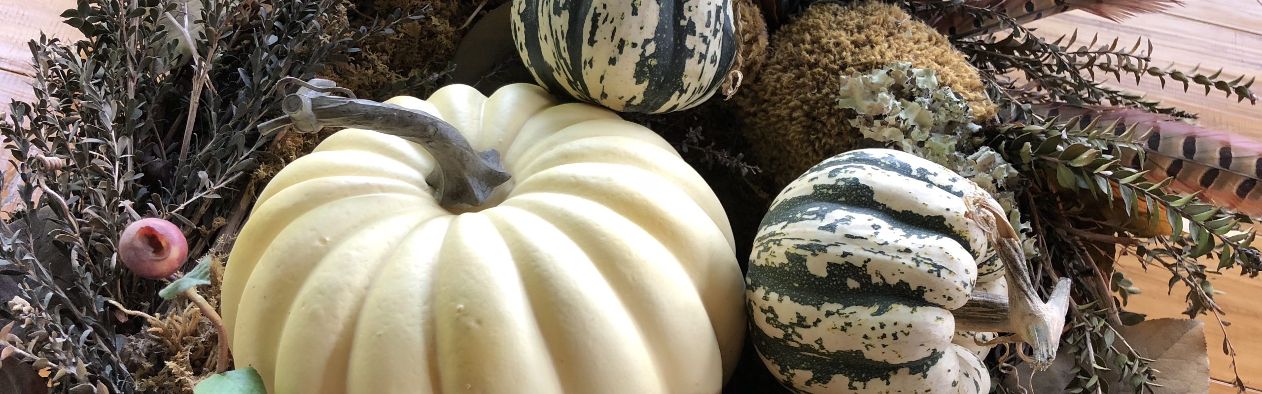
Hoodoo Basics
Cliffs erode, creating narrow rock walls called fins, and eventually the fins crack enough to create windows like those at Arches National Park. After a few million more years, the tops of the arches collapse, creating hoodoos.
The Park is just over 9,000’ at its highest, and its snow/ice, freezing/warm temperatures have created its tens of thousands of hoodoos—the world’s biggest collection. The plateau cliffs recede about a foot every 50-60 years, and you can see evidence of Park fencing moved back and trees hanging over the edge.


Best Story of the Mighty 5
Ebenezer Bryce converted to Mormonism and moved to Utah in 1850. At just 18 years of age, he began a church-directed life as a serial homesteader helping settle new communities throughout Utah and Arizona. He is credited with discovering the canyon while searching for a lost cow. He is famously known to have said it was “A hell of a place to lose a cow.” For four years, he lived in the area and built a road into the canyon to harvest timber. Locals called it Bryce’s Canyon, and the name was immortalized in 1928 when the National Park was established.


This is one place I wish I had been able to hike. I would love to have the experience of being at the bottom of the towering formations. There are numerous trails in Bryce Canyon, and we spotted distant hikers moving around way below us. Climbing back up would be quite a challenge.


BTW, for those interested, Bryce Canyon had the best gift shop of any of the Mighty 5 Gift Shops we visited.
If you’d like to see more posts about our visit to the Mighty 5, check these out: Capitol Reef, Arches & Canyonlands


This morning, we packed up and headed southwest towards Capitol Reef National Park. Capitol Reef is a Waterpocket Fold – an actual wrinkle in the earth. Extending almost 100 miles, it took millions of years to form. The shaping, lifting, twisting, and erosion has left us with an amazing array of vistas. Cliffs, domes, arches, and canyons all displayed in a wide-ranging palette of colors and hues only nature can create. Some early visitors thought one of the domes resembled the U.S. Capitol, thus the name.
The big excitement for me this day, was finding out I was going to see petroglyphs. I knew there were others in Utah, but they were farther north and out of the range of this trip. So for me, this was a real bonus.


These rock carvings date from <300-1300 and are believed to be from the ancestors of the Hopi, Zuni, and Paiute tribes. They represent journeys, deities, animals, maps, clan symbols, and calendars. The culture seems to have vanished after 1300. The petroglyphs were hard to distinguish at first. I’m glad we had a guide to help us figure out where they were on the very large rugged cliff wall. (Based on the appearance of some of the figures I’m sure some attention-seeking wackos will claim they are proof of aliens).


We left Capitol Reef, enjoyed a delicious lunch in Torrey, and took the wonderful All American Highway 12 through the Grand Staircase-Escalante National Monument. It was a beautiful drive and I was happy to be a passenger for the ride and not the driver. Of note, we also traveled through the Dixie National Forest, which got it’s name from its warmer climate, the Mormon effort to grow cotton, and early Southern settlers.
Utah is a major dinosaur fossil and bone discovery area. At least six new horned dinosaur species have been found within the National Monument. The head of the one shown below was the first to be discovered, and is named Utahceratops Gettyi, after the field paleontologist who found and collected it.


At the end of a long day, we arrived in Bryce Canyon City. Before we turned in for the night, we enjoyed dinner and a show at Ebenezer’s Barn & Grill. This was another big surprise. The food was good (I had excellent salmon) and the country show, featuring the Bryce City Wranglers, Nashville-worthy. It’s a perfect mid-way stopping point on a tour of the Mighty 5.


If you enjoyed this post, you might like to check out more of the Mighty 5: Arches & Canyonlands


The Mighty 5
Moab is the perfect jumping off spot for visiting the Mighty 5 U.S. National Parks of Southern Utah. The Mighty 5 encompass Arches, Canyonland, Capitol Reef, Bryce Canyon, and Zion National Parks. We took a three-day trip with Moab Express, arranged through Rocky Mountaineer (although you can also book directly). Initially, I was worried we might not get to see everything we wanted – but happily, we did.
I’m going to blog about this portion of our trip in three posts, this first about Arches and Canyonlands, followed by Capitol Reef, and finally Bryce Canyon and Zion.
Arches National Park – Minutes Away
After an overnight in Moab, we set off early under direction of our wonderful, relaxed, and efficient guide, Mark. Our van was well equipped with plenty of water, snacks, and phone charging ports. These parks do not have food concessions or many facilities. Bathrooms are at the Visitor Centers and that’s about it.


First up, Arches National Park, home of 2,000 catalogued arches. I’m going to let the pictures tell this story, even though they do not begin to do justice to the majesty of any of these incredible parks.


The “Balanced Rock” Trail circled around this massive fear-inspiring formation seen below. I didn’t linger.


The Most Famous Arch


We got plenty of steps in walking around the arches and formations, but we did not hike to “Delicate Arch”, the iconic image on Utah license plates. As you can see from this photo, the image on the tag is shot from the opposite perspective. It was getting very hot and we were very content to see it from a distance.
Canyonlands
After a picnic lunch outside the Arches Visitor’s Center (arranged and brought in advance by the Moab Express folks), we headed a little over 30 miles towards Canyonlands. Here our perspective dramatically changed from looking up to looking down.


Canyonlands is considered a “wilderness of rock” and is very large, with several entrances. We visited the Island in the Sky section. This area features a broad mesa between the Colorado and Green Rivers. It gets less than 10” of rain a year. The horizon semed to go on forever.


Moab Tips:
In Moab, the Hoodoo Hotel Curio by Hilton was really lovely but don’t stay in room 117! It is over the laundry and one wall and the beds vibrate when the machines are in use (which is very often). It feels pretty much like you are over the engine room on a cruise ship.
The Sunset Grill which is a famous local restaurant was a huge disappointment. It has a wonderful view and an interesting history as the former home of Charlie Sheen the “Uranium King,” but fell short of delivering us a good meal. It turned out to be the only real disappointment on this trip.
Across from the Hilton there is a Food Truck Park with lots of choices, and really delicious gelato.
Be forewarned that Utah has strict liquor laws, including that mixed drinks can only have 1.5 ounce of liquor. And, they won’t serve a second drink until that one is consumed. FYI – my bourbon Old Fashion at Sunset Grill was $25! I should’ve asked for extra cherries.


What a great way to enter the Mighty Five National Parks of Southern Utah. Rocky Mountaineer’s first U.S. venture – Rockies to the Red Rocks will get you there in style.


We left Denver early for the day-and-a-half trip to Moab, Utah, with an overnight stop along the way in Glenwood Springs. Don’t eat breakfast before you leave, because service begins as soon as you are on board and presented with just-out-of-the-oven blueberry scones and mimosas (or whatever you’d like to drink) to get you going.

This route has two classes of service – SilverLeaf and SilverLeaf Plus. SilverLeaf Plus gets you access to two lounge cars – one with bar service and the other a quiet car with classical music and no commentary.
But the commentary was a big part of the fun. Our lively Rocky Mountaineer hosts, Olivia, assistant Sabina, bartender Lee, and Chef Rae, kept us well-fed and awake for the changing scenery we saw around every turn. Literally, scenery changed around each curve.


We traveled through forests, gorges, canyons, along rivers, and past peach orchards.
Just outside Denver, we experienced our first railroad feature, the Big Ten Curve. Curves like this use a 10-degree radius to keep a two-percent grade and a more comfortable, safer route. You could look back over the horizon and see the distant, blurry skyline of Denver as well as the entire train.

On our way up to the Continental Divide, we passed through 30 tunnels in 13 miles. But the Granddaddy of all tunnels was the six-mile-long Moffat Tunnel. This one-track engineering marvel was blasted through the rock, and in 1980 was designated a National Historic Civil Engineering Landmark. Being one track, we had to wait for another train to pass from the other direction before we could enter. Good thing our train was well lit – it would not be for the claustrophobic.


The gently flowing Colorado River eventually gave way to rapids in the Gore Canyon area, one of several dramatic canyons on this part of the trip. Since we were along the river for so much of our trip, we did see folks fishing, rafting, and kayaking. We even got a full moon salute at one point! The animals pictured above are Dzo – a cross between yak & cow.
I don’t have an exact stat for how high we got, but it was in the 8-9,000’ range.


Pictured above: Top R: the train station in front of our hotel. Middle: Hotel Colorado. Lower left: the famous Hot Springs.
After our first day on the rails, we spent the night in Glenwood Springs, a cute, walkable historic town originally called Fort Defiance. The famous Hotel Colorado often hosted President Theodore Roosevelt, who stayed here while big game hunting. We walked across the pedestrian bridge over the river from our own 100-year-old hotel (Maxwell Anderson) to check out the famous spot and springs. Other famous names who frequented the Hotel Colorado were the iconic (Unsinkable) Molly Brown, and Chicago mobsters “Diamond Jack” and Al Capone.
I loved spending time in the vestibules between our main car and the two lounge cars. They were safe spots with open windows on both sides. We had glorious sunny days, and the dry, cool breeze was delightful. It was also a great spot to take pictures without any glass obstruction. The Canadian Rocky Mountaineer trains have a small outside platform, but the vestibules are the only open-air option on the American line.
Rolling past farms, small towns and ghost towns, livestock, vineyards, dams, and reservoirs, we were also privileged to see several nesting bald eagles. All passengers were on the lookout for wildlife, and we did spot elk, mule deer, and pronghorn at various points. As I said at the beginning, what a great way to travel. Relaxing, fun, interesting, informative, and delicious. Mere handheld photos don’t capture the scenery or the feel of the experience.


As the landscape turned from green to shades of browns and reds, we went through the De Beque Canyon, saw the striking Book Cliffs, and eventually reached the spectacular Ruby Canyon, famous for its massive red sandstone cliffs. It was here that we entered Utah and soon reached our final destination of Moab.
Next up – touring the Mighty Five National Parks.
Of Note: The last pic shows I-70 in an equally dramatic double-decker run along the river. In Canada, the Rocky Mountaineer trains are two levels, with dining down below. In the U.S., the tunnels are not quite high enough for the double height, and so the trains are one level, and passengers are served at their seats. In the U.S., there are two classes of service, SilverLeaf and SilverLeaf Plus. SilverLeaf Plus gives you access to the lounge cars and vestibules between them, as well as enhanced adult beverage options. It is equivalent to the GoldLeaf service on Canadian routes.


")
")
")

")


